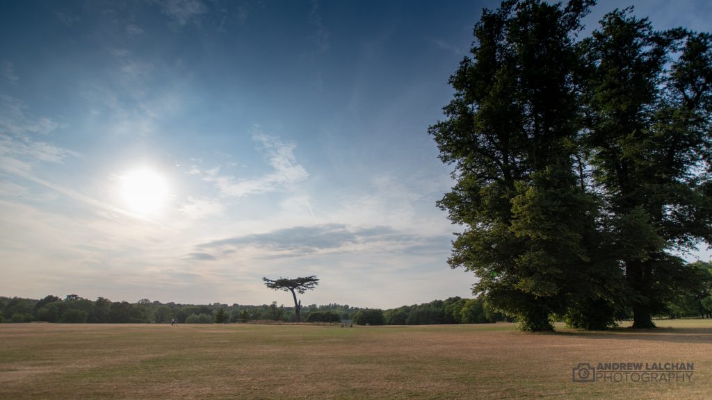
What a fabulous June we have had, following on from the magnificent May, its been continuous blue skies for some in the UK. Although if you have been on the eastern side of the UK its been cool and cloudy persistantly. High pressure has been dominant through out bringing a hot start to summer.
The CET (Central England Temperature) ended up at 16.1c which was 1.9c above the long term average, which makes it the 3rd month in a row above average. Which is also the 4th month this year and they have all been significantly above average, more than 1.5c. Only February & March have been below. The CET would have been much higher if it wasn’t for the fresh nights which kept the minimum average down.
UK Stats
Its been a dry month country wide especially so in the south and east. With temperatures very high across the country the highest temperature of the year occurred on 29th with 33c in Porthmadog (Wales) but this might be pipped if Motherwell (below) is confirmed.
On 28th we had the highest temperature of the year in Northern Ireland, Scotland, Wales and England all over 30c, this hasn’t happened for a while. Scotland also had its highest temperature of 33.2c at Motherwell since records began on the 28th.
UPDATE : The Motherwell record has now been investigated and not accepted, you can read more here.
Overall it has been the warmest June in Northern Ireland & Wales since records began. Only the 4th warmest for Scotland & England. In terms of sunshine it has been the 4th sunniest since records began in 1929, only beaten by 1975, 1957, 1945.
For rainfall it was the 3rd driest on record (since 1910), the highest rainfall in 24 hours was at Achnagart (Ross & Cromarty) with 44.6mm on the 14th. Also on the 14th, the highest wind gust of 74mph for the month was at Orlock Head (County Down). The lowest temperature of the month was -1.1c at Altnaharra (Sutherland) on the 8th.

Watford Stats
I have been recording weather data from my weather station since 1982 and this has been the first time that I have recorded less than 1mm of rain in any month. For June in Watford I only recorded 0.9mm of rain, 2 days had rain and the rest dry! The highest temperature I recorded was on the 25th with 32.4c there was also 5 more days over 30c. Pressure has been high for most of the month and winds predominantly from the east or SE.
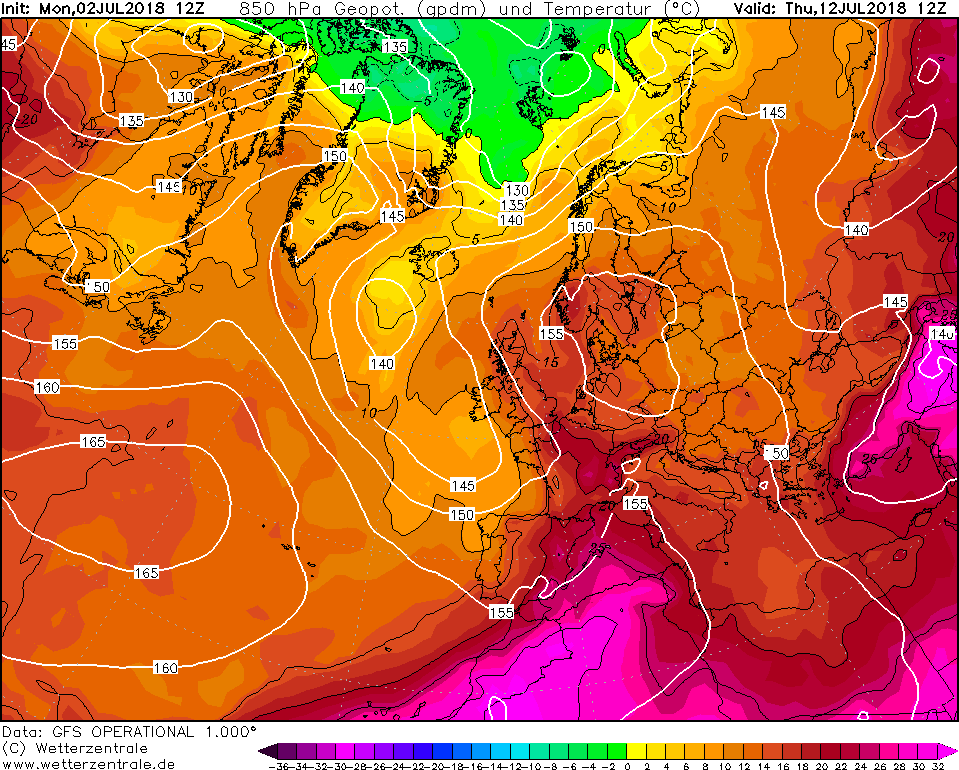
Looking ahead to July
Most of the computer models are showing a continuous higher probability of high pressure being around the UK with the brief incursions of low pressure coming up from the Bay of Biscay. I think this will continue into the rest of July with only brief incursions of Atlantic weather. This could be a record breaking summer or on par with 1975. The change in the weather can be rooted back to the beast from the east in the winter, this was when we started getting easterly winds and this has continued during the spring / summer. I think July could possibly break the all time record and get t0 37c mid month.
Summary for June 2018 in Watford
Temperature (°C):
Mean (1 minute) 18.3
Mean (min+max) 19.3
Mean Minimum 11.7
Mean Maximum 27.0
Minimum 7.1 day 05
Maximum 32.4 day 25
Highest Minimum 16.2 day 18
Lowest Maximum 19.6 day 17
Air frosts 0
Rainfall (mm):
Total for month 0.9
Wettest day 0.6 day 17
High rain rate 3.6 day 09
Rain days 2
Dry days 28
Wind (mph):
Highest Gust 12.1 day 14
Average Speed 0.4
Wind Run 312.1 miles
Gale days 0
Pressure (mb):
Maximum 1025.6 day 21
Minimum 1001.7 day 14
Links
Met Office – https://www.metoffice.gov.uk/hadobs/hadcet/cet_info_mean.html
Real time Watford Weather – https://weather.andrewlalchan.co.uk/
Flickr – httpss://www.flickr.com/photos/alalchan
Weather Outlook – httpss://www.theweatheroutlook.com/twocommunity/
May 2018 – https://blog.andrewlalchan.co.uk/watford-weather-may-2018-statistics/


