A month of thirds with a very warm middle surrounded by cold. The CET ended up at 4.97c which made it an average month. At one point with 10 days to go the CET was over 2.5c above normal but the very cold end brought this backdown. It was also a month of very wet weather especially in the midlands which saw extensive flooding from some named storms.
In the last week of the month the jet stream has parked itself south of the UK which means we are on the cold side hence more chances of snow across the UK. Whether the south gets any snow it will depend on the how cold the upper air is and if it gets modified by the north sea which after a warm autumn it is still has some way to cool down.

UK Stats
It has been a predominantly northerly month but with a week of winds from the south which brought the temperatures up a lot and especially warm nights. Some places had a decent covering of snow at the beginning and end of the month. Makes up for seeing no snow last winter.
14.9 °C was the maximum temperature it was recorded at Prestatyn (Clwyd) on the 18th. On the 30th a minimum temperature of -10.2 °C was recorded at Dalwhinnie (Inverness-shire). At Honister Pass (Cumbria) on the 27th 109 mm of rain fell. On the 27th a wind gust of 106 mph was recorded at Needles (Isle of Wight). A depth of 18 cm of snow was recorded at Loch Glascarnoch (Ross & Cromarty) on the 31st.
Watford Stats
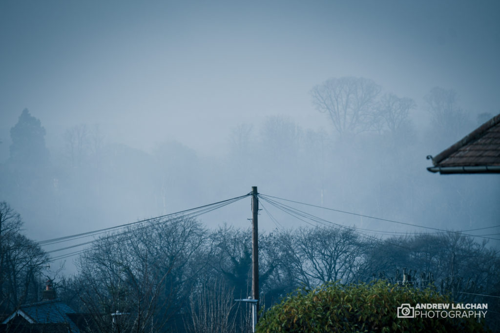
It has turned out to be an average month temperature wise with the highest temperature at 13c on the 21st. The lowest was -2.3c on the 7th, Watford also had 9 air frosts. These mainly occurred at the end of the month, two days had snow falling.
The rainfall during the month has been around average with 40.5mm with the wettest day on the 26th. Also, 19 days were rainy, it was windy on the 26th with a high gust of 27.3 mph.
Looking ahead to January
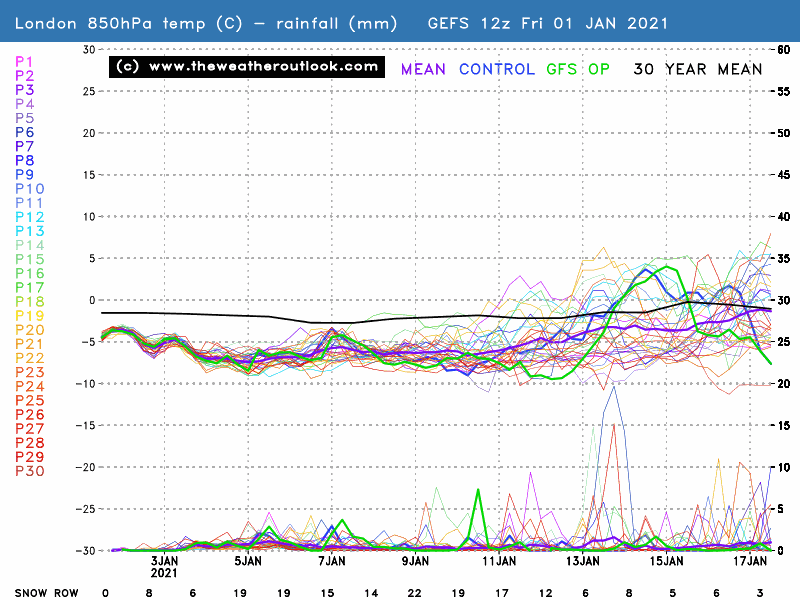
Long-range computer models have been suggesting for weeks that January is going to be cold to very cold. Though there may be a warm-up mid-month. But with also the SSW (Sudden Stratospheric Warming) event occurring at the beginning of the month, this could be the catalyst for even colder weather.
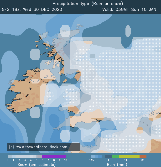
The image below is for the 10th January which shows a very snowy day and the chart below that shows the computer model outlook for London showing the 30 computer runs which are all below the long term average for the next 10 days. Find out more on the weatheroutlook which shows the various weather models.
Summary for December 2020 in Watford
Temperature (°C):
Mean (1 minute) 5.6
Mean (min+max) 5.6
Mean Minimum 3.1
Mean Maximum 8.1
Minimum -2.3 day 07
Maximum 13.0 day 21
Highest Minimum 10.0 day 18
Lowest Maximum 1.2 day 31
Air frosts 9
Rainfall (mm):
Total for month 40.5
Wettest day 7.8 day 26
High rain rate 25.2 day 23
Rain days 19
Dry days 12
Wind (mph):
Highest Gust 27.3 day 26
Average Speed 1.3
Wind Run 986.1 miles
Gale days 0
Pressure (mb):
Maximum 1025.6 day 25
Minimum 963.7 day 27
Days with snow falling 2
Days with snow lying at 0900 0

Links
Met Office – https://www.metoffice.gov.uk/hadobs/hadcet/cet_info_mean.html
Met Office Summary – https://www.metoffice.gov.uk/climate/uk/summaries
Real-time Watford Weather – https://weather.andrewlalchan.co.uk/
Flickr Winter Photos – https://www.flickr.com/photos/alalchan/albums/72157717256371497
Weather Outlook – https://www.theweatheroutlook.com/twocommunity/
November – https://blog.andrewlalchan.co.uk/watford-weather-in-november/


