The beast from the east is about to strike! Its been over 30 years since we have had a continuous wind this cold from the east in winter, originating all the way from Siberia. We are lucky that this is happening at the end of winter when the sun is starting to get higher in the sky as this would be even more bitter in the middle of winter than how it’s going to feel. It will still be very cold with sub-zero temperatures by day & night. There is the possibility of date records going on Wednesday / Thursday next week, certainly, plumbers will be busy when the thaw happens.
This blog post is more focused on Watford where I live, my live weather station will be running here showing local conditions. I will be updating it daily. Check out my weather section with links to the real-time radars to see where it is going to snow.
Look out for my review of the Beat from the East in a further blog.
Day 9 – 2nd March 2018
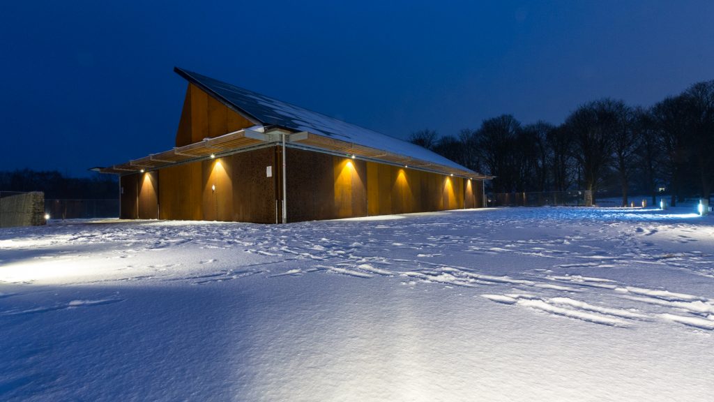
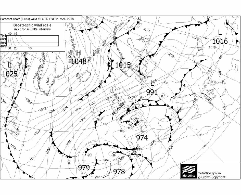
The beast has been slain, after 8 hours of snow another 5cm of snow had fallen giving a wintry scene. This snow was of the wetter variety, it started off as freezing rain, then ice pellets and heavy/moderate snow. The snow stopped at around 8pm having started at 1pm.
After midnight the temperature continued to rise and went above 0c for the first time since the 26th. The thaw has set in, after a spell of heavy rain on Saturday afternoon, most of it will have been washed away. It wouldn’t be very mild for the next few days and by next weekend we could have another spell of snow. Although most people will be looking for the warmth it could be nearer the end of the month. Easter is also coming up and it is more usual to snow then that at Christmas.
It was a memorable spell in Watford but didn’t beat 1987 which lasted much longer and had much more snow. But it’s good to see heavy snow in temperatures of -4.5c which is unusually for Britain. Elsewhere in the country it was probably one of the most exceptional weather events and beat 1987. Read more on my review of the Beast from the East coming in the next few days with all the records that were broken.
Max temp : 1.6c | Min temp -1.8c | Max wind gust 18.3 mph (E) | Rain – 0mm | Snow falling – yes | Snow depth – 7cm
Day 8 – 1st March 2018
Has Emma slain the Beast from the East? Welcome to the meteorological spring, on the coldest March 1st day on record. Nearly everywhere in the UK spent the day below 0c, and some places far below in places like Devon, west country. These places are normally mild but they had record amounts of snow, in some places over 50cm! In the next few days, all the stats will be placed in here on this extreme cold spell.
Here in Watford, our max temperature was -0.6c and it was very windy making the wind chill extreme, at one point in the morning it was -7.8c. It snowed all day, probably depositing around 2cm but hard to tell as the strong winds were whipping the snow into drifts.
For the next few days, this cold spell looks to be coming to an end, it will become less cold on Sunday, possibly up to 5c with a slow thaw of lying snow. Before that, there may be 2 more spells of snow, one later on Friday where 5 – 10cm could fall. The air is still below 0c, so it would be snow falling over our area. The 2nd spell is on Saturday, behind this weather front is the milder air, so it could start as snow and then change to freezing rain and then normal rain.
But further out the easterly cold winds could be back later next week but not as severe.
Max temp : -0.6c | Min temp -4.4c | Max wind gust 15.9 mph (E) | Rain – 0mm | Snow falling – yes | Snow depth – 11cm
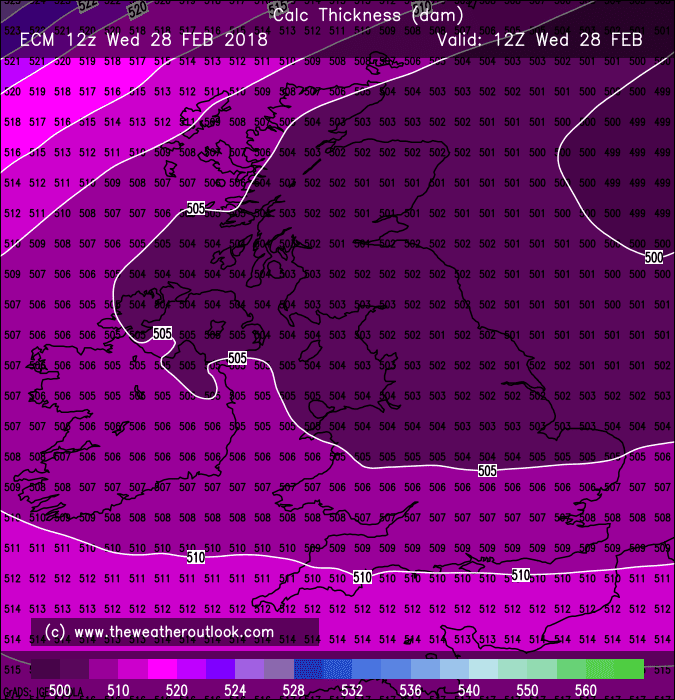
Day 7 – 28th February 2018
What a day, it was bitter out in the biting wind. The wind cut through you even if you had many layers on, I haven’t experienced that for a long time, not since the 80s. It was the first sub-zero-day in 20 years, I think. I will have to go through my previous records back since 1982.
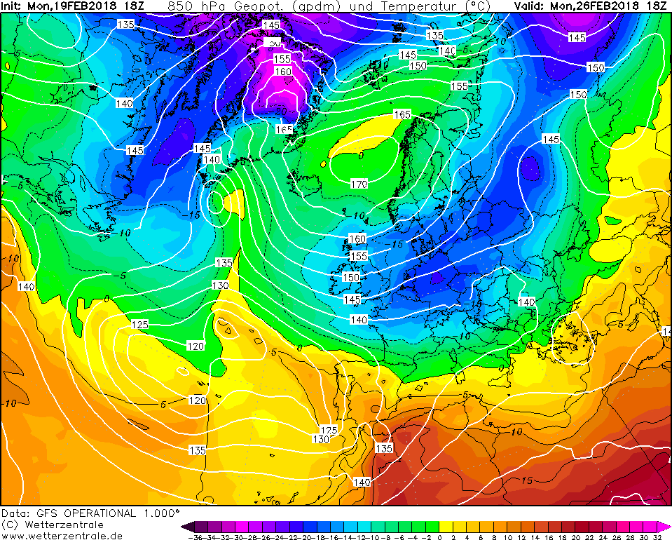
Today is the last day of the meteorological winter and the beast was going out with a bang, today was the peak of the cold with the -17c 850hpa over the country. You would normally see that in the north pole on a balmy day for up there.
At the end of day, we even had a lake effect streamer set from the north sea along the Thames estuary and sat over Watford for a good 8 hours giving moderate to heavy snowfall. Around 9cm fell from this streamer, but with the increase in wind, it soon blew into drifts. It was interesting to see how it formed and then later in the night interact with Storm Emma coming up from the south.
Max temp : -1.2c | Min temp -5.5c | Max wind gust 15.9 mph (E) | Rain – 0mm | Snow falling – yes | Snow depth – 9cm
Day 6 – 27th February 2018
Its been very snowy with lots of showers and they got heavier during the day, but with the warmth of the sun at this time of the year, the snow melted. So no large totals of settled snow, this will come later in the week. Wednesday is the peak of the cold weather with extreme polar air over us for 24 hours. If there are any clear, calm conditions overnight then the temperature will plummet. Watford got its lowest temperature for some time at -5.3c and will probably have our first ice day since 2010. This is where the temperature doesn’t go above 0c for 24 hours. All the stats each day have been from 9am.
Looking further ahead for the end of the week it’s looking like the low pressure coming up from the south which has been named Emma is going to stay to the south of us initially and throw bands of precipitation northwards. This will turn to snow when it hits the land, the first one on Thursday will be heaviest near the west country where they could have 20 – 30cm of snow further east more than likely 5 – 10cm. But it hasn’t firmed up on how big the band of precipitation will be. A second band will come up on Friday which will be of snow this will most likely be more potent for the SE and give a 5 – 10cm of snow. By Saturday it will feel less cold and the snow could turn to rain.
Max temp : 3.1c | Min temp -5.3c | Max wind gust 9.2 mph (ENE) | Rain – 0mm | Snow falling – yes | Snow depth – 2cm
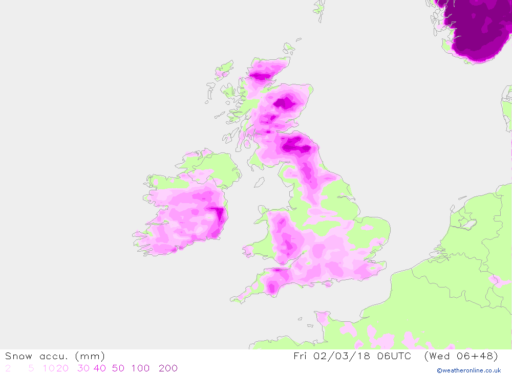
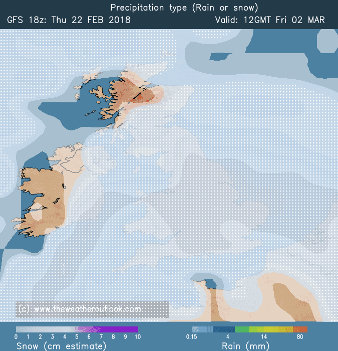
The chart below shows the next 48 hours accumulation of snow from EURO4, there looks to be a deluge of snow across the south, we shall have to see.
Day 5 – 26th February 2018
The day started with plenty of snow showers packing in from the North Sea, they first started from east to west going up the Thames estuary and then veered NE, but unfortunately, if you want snow, it melted even though the temperatures were at 0c. This is to do with the sun so high in the sky and has a lot of warmth. Overnight the showers faded away from our area but the cold was enhanced. Temperatures went down to -4c the lowest since December in Watford. On Tuesday the showers should become bigger as we approach the coldest day of this cold spell. Also a risk of thunder in the heaviest snow showers. The upper air temperature at 850hpa will be -15c to -20c one of the coldest recorded for late February and its a rare sight in Britain.
Further, in the week, low pressure is still forecast to come up from the south but the computer models are having a hard time getting a fix for this as the jet stream is far away from it, going into Spain. It could bring blizzards to the south or it might not arrive, watch this space.
Max temp : 3.5c | Min temp -4.0c | Max wind gust 13 mph (ENE) | Rain – 0mm | Snow falling – yes | Snow depth – 0.25cm
Chart of the day is for the fax chart from the Met Office for Friday, it shows the low-pressure system much further south and west than previously shown. Still close enough to bring a spell of heavy snow for the south on Friday, but this will prolong the cold spell into next week.
Day 4 – 25th February 2018
Very sunny day again which pushed the temperatures up to 7.2c, felt like spring if you kept out of the wind! But the Siberian express checks in around midnight in Watford. Snow showers have started appearing on the radar and will break out widely in the early hours, the light at first and then start to get heavier. At 4am the -15c 850hpa arrives which wouldn’t have stayed in the UK for this long, for years.
Max temperature : 7.2c | Min temperature -1.6c | Max wind gust 11.4 mph (E) | Rain – 0mm | Snow falling – yes | Snow depth – 0cm
Chart of the day is this from the UK Met Office, it is unusual to see a polar converging streamer shown on a fax chart. Somewhere along there is going to get a dumping of snow.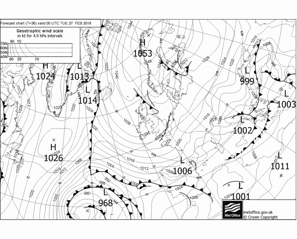
Met Office Fax chart
Day 3 – 24th February 2018
The Siberian Express has left the station, next stop is London and the rest of the UK!!
Its been a much sunnier day on Saturday and hence it has felt much warmer in the sunshine as we are close to spring and the sun is much higher in the sky.
The wind has increased though and will be more noticeable on Sunday. Sunday will start to bring in snow showers off the North Sea as the very cold air envelopes the country.
For the next 4 days, expect these showers to give a covering, they will band together and could give 5 – 10cm in the Watford area.
Max temperature : 8.4c | Min temperature -1.6c | Max wind gust 12.1mph (E) | Rain – 0mm | Snow falling – no | Snow depth – 0cm
Chart of the day goes to the one below showing the snow risk for next Friday, the computer models are increasing showing this low pressure moving up from the Bay of Biscay and moving further north than shown previously. This will initially result in blizzards across the south of the country but increasingly warm air will be mixed in which will result in the possibility of rain late on Friday on the south coast. For Watford, I think it will stay as snow until Saturday but it will be wetter large snowflakes instead of the smaller snowflakes at the beginning of the week. Some places will get over 50cm of snow. The snow type is dependent on how cold the air is up above, the colder the air the smaller the snowflake.
Over the whole week, I am expecting a minimum of 10cm of snow in the Watford area. Lots of weather to get through before Friday though, lots of it could be record-breaking.
Day 2 – 23rd February 2018
Its been a much cloudier & dry day with the odd flash of the sun, the wind has picked up more and it was a very frosty start to the day. New Met Office amber warnings have been issued for next week for the extreme cold / snow. The computer models have been churning out their daily runs and it is looking like the cold has been upgraded for next week. The GFS model is still bringing up a snow storm for Thursday / Friday with also the possibility of warmer temperatures turning the snow to rain. None of the other models are showing this.
Max temperature : 5.3c | Min temperature -2.3c | Max wind gust 11.4mph (E) | Rain – 0mm | Snow falling – no | Snow depth – 0cm
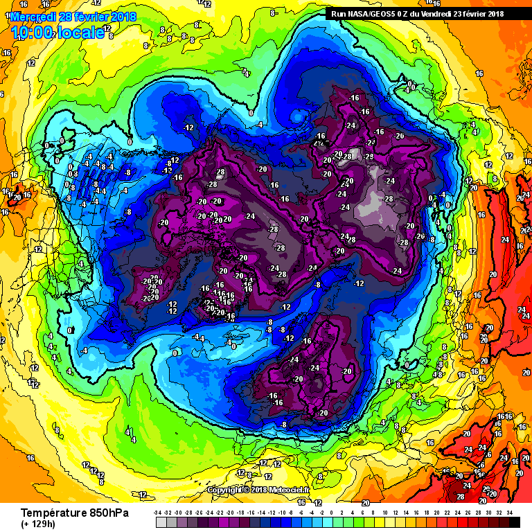
Chart of the day goes to the one below from NASA showing the 850hpa of -20c approaching Scotland, last time that occurred was in January 1987.
Check out this in the Met Office archive from 1881, the Meteorological Magazine of the cold in February that year.
I will document this memorable weather during the next two weeks, starting from today 22nd February 2018. Each day till the end of this spell, you can find out more about how my interest in the weather started here.
All the computer models have now firmed up on the easterly winds, so this is over 90% certain. Where snow falls is less of a known quantity in any particular place. It is hit and miss affair with the showers, so initially this will be showers moving off the warm North Sea, with the brisk wind and the very cold air high up in the atmosphere. This will generate turbulence in the air above the sea, I expect there will be lots of showers. It will be like the lake effect snow in the USA, they could band together bringing heavy falls of snow.
I remember the 1987 winter in Watford this was the last severe period of really cold wintry weather we had, schools didn’t stop back in those days we still went to school in snowdrifts. It felt fun at the time, I loved watching the icicles grow and then the dreaded drip drip as they disappeared.
What were your memories of that period? leave a comment below.
Day 1 – 22nd February 2018
We currently have had a gentle easterly wind all day which has felt warm in the sun but as soon as you get into shade you can feel the cold wind. This is likely to feel 10 times as cold next week when the true Siberian winds arrive on Sunday.
Max temperature : 8.3c | Min temperature -2.6c | Max wind gust 7.6mph(E) | Rain – 0mm | Snow falling – no | Snow depth – 0cm

Links
Weather Outlook – httpss://www.theweatheroutlook.com
Weather Online – https://www.weatheronline.co.uk
Met Office – httpss://www.metoffice.gov.uk/
Instagram – https://instagram.com/alalchan
Flickr Photos – httpss://www.flickr.com/photos/alalchan